A muti-faceted plan for rescue was developed to ensure the safety of a group of hikers injured in severe terrain, far removed from any local assistance
Severe altitude sickness can be fatal, and often leads to secondary affects contributing to life threatening conditions, such as the inability to move under one’s own power. Extracting four adult males from a high-altitude bivouac surrounded by severe topography required the massive coordination of ground rescue teams, maritime transportation, and a rescue helicopter who worked together to move ambulatory personnel over a great distance.
The initial report
On September 2019, the MAGNUS Control Center received an SOS notification from a group of backpackers in a remote location of Tajikistan. At an altitude of 4,300 meters, the group of four—aged 20-23, and recently discharged from military service—had activated their satellite beacons three days into a journey into the interior of the Pamir Mountain Range. Using their MAGNUS-issued devices, the group reported that one of the hikers was exhibiting symptoms of advanced altitude sickness, including headaches, dizziness, nausea, blurred vision, and extreme fatigue.
The MAGNUS team had to act quickly to assist this seriously endangered traveler.
Operational Challenges
- Over the course of three days, the hikers had ascended at a rate far surpassing recommended guidelines for high-altitude trekking, impacting the faculties of all members of the group. Competitive inter-team dynamics prevented the attempted mitigation of these symptoms until it was a last resort.
- The group's location was hundreds of kilometers away from the capital city of Dushanbe (the only city with central medical services) and from civilization in general, deep within the remote area of the Pamir Mountain range.
- Medical and topographical conditions combined necessitated a helicopter extraction.
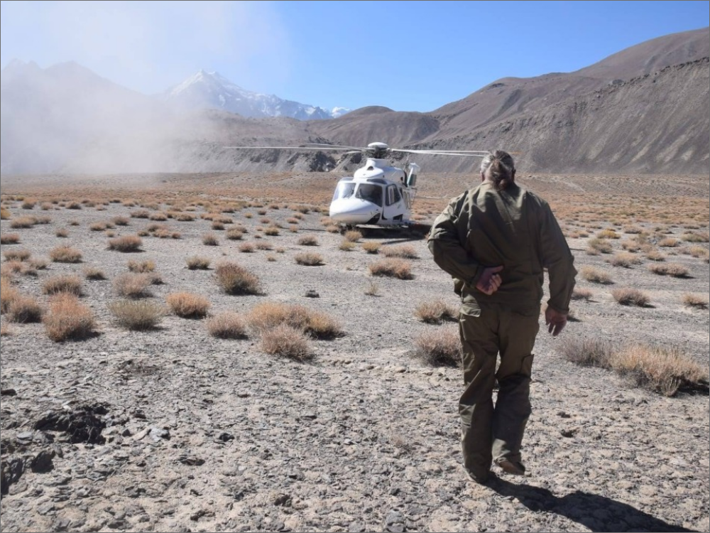
- The severe terrain of the Pamir Mountain range added complexity to landing zone selection and flight planning.
- Due to the limitations of the particular airframe used, take off angles were less forgiving than approaches for landing, further limiting landing zone selection.
Mission Phases
- Immediately following the notification of the potential for high-altitude sickness, the MAGNUS Control Center connected the Desk Physician—an expert in field medicine and emergency medical response—directly with the travelers, providing clear instruction for the taking of medications in the field.
- Communication continued to be supervised by the Control Center, the lead supervisor on duty, and the Desk Physician. These three entities regulate the communication and ensure that there is no deterioration in the medical situation of the traveller and manage the efficient flow of information. A 30-minute communication window was established between the hikers and Desk Physician.
- In conjunction with flight planners, the Control Center analyzed possible evacuation routes limited by environmental and human factors. Simultaneously, the Control Center dispatched a local rescue team to make ground movement to the hiker’s remote location.
- Utilizing vehicles and horses, the local rescue team reached the travelers remote location within 48 hours, providing food, warm blankets, oxygen tanks, and medicine to the immobile hikers.
- Upon arrival, the rescue team was directed by the MAGNUS Desk Physician in efforts to stabilize the travelers. In accordance with the Doctor’s orders, the travelers were administered supplemental oxygen and additional medication.
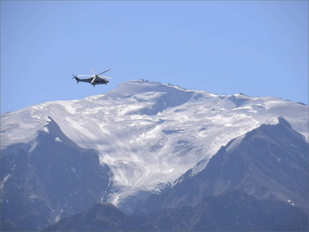
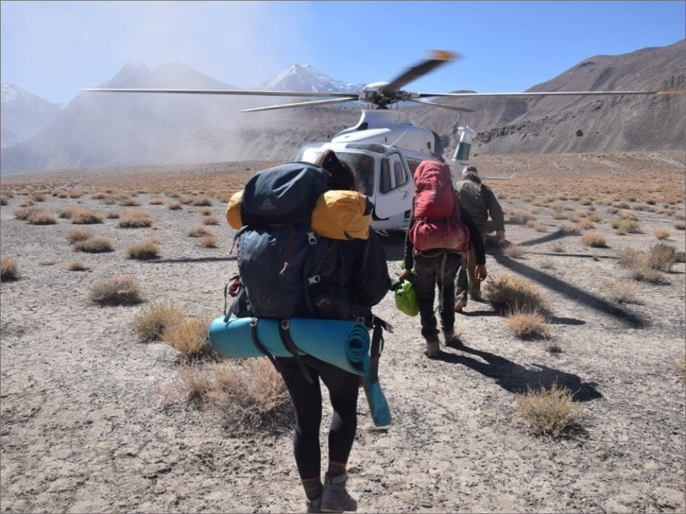
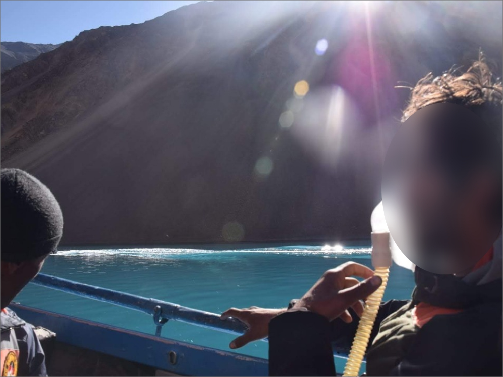
- Leveraging advanced imaging technology, the Control Center identified the nearest suitable helicopter landing zone to the group, across a nearby lake, approximately 40 kilometers from the group. A Rescue helicopter was dispatched to this point.
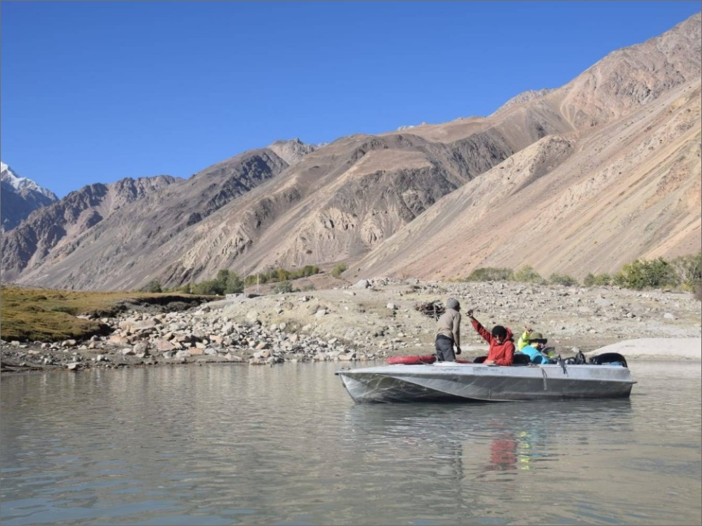
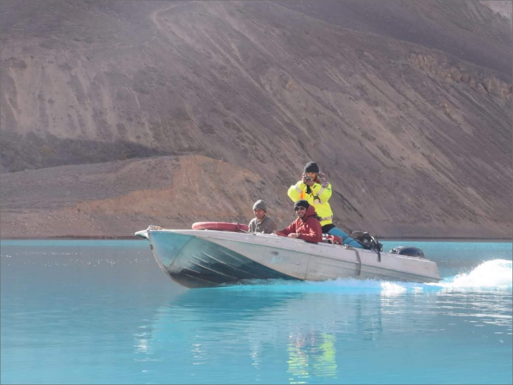
- The rescue team utilized horses to descend the valley with the hikers and supplied oxygen tanks, meeting a motorized boat at the lake’s edge and prepared the team for a water transit—all monitored and managed by the MAGNUS Control Center.
- The team successfully transited 20 kilometers across the lake, were received by the helicopter rescue crew, and evacuated to the capital of Dushanbe to receive additional medical treatment.
Track the
MISSION
Use the mouse wheel to zoom in and out on the dynamic map
You can also open the map in a large view in a new tab
The rescue team
More
Case Studies